


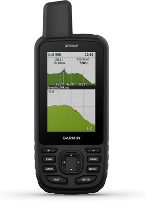
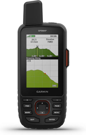
Garmin GPSMAP 67 Rugged GPS Handheld
Estimated Delivery by: --

Garmin GPSMAP® 67 Rugged GPS Handheld – Outdoor Navigation & Mapping
Button-operated 3″ sunlight-readable GPS handheld with preloaded TopoActive maps, multi-band GNSS, ABC sensors, LED flashlight, MIL-STD-810 durability, and up to 180 hours battery life (840 hours Expedition mode). Navigation without satellite messaging.
Our Take: The GPSMAP 67 is the navigation-only sibling of the popular GPSMAP 67i — same rugged hardware, same proven interface, same military-grade build, but without inReach satellite messaging. If you already carry a separate satellite communicator (like an inReach Mini) or stay within cell coverage, the GPSMAP 67 saves you $100 over the 67i while delivering identical GPS performance. The button-only interface is polarizing — it's slower for map browsing than a touchscreen — but it's completely reliable in freezing rain, with thick gloves, and with muddy hands. For backcountry navigation where dependability matters more than speed, this is one of the most battle-tested handhelds Garmin makes.
Why you'd choose the GPSMAP 67
-
Transflective 240 × 400 pixel display with chemically strengthened glass. Bright and readable in direct sunlight. Button-operated for reliable use in rain, cold, and heavy gloves.
-
Detailed maps for roads and trails with terrain contours, elevations, and points of interest out of the box. Download high-resolution satellite imagery via Wi-Fi. Optional Outdoor Maps+ subscription for land boundaries and wildlife areas.
-
Access GPS, Galileo, and QZSS on multiple frequencies for improved positioning in dense forest, steep canyons, and urban environments. Consistent accuracy within 6 feet in real-world testing.
-
Up to 180 hours in standard GPS mode — longer than the 67i's 165 hours because there's no inReach radio drawing power. Expedition mode stretches to 840 hours (35 days) with reduced tracking frequency.
-
Built-in altimeter for elevation, barometer for weather trends, and 3-axis electronic compass for direction. LED flashlight doubles as an emergency beacon. Night vision goggle compatible.
-
U.S. military standard for thermal, shock, and vibration testing. IPX7 water rating (submersion up to 1 meter for 30 minutes). Built to survive drops, temperature extremes, and sustained rain.
-
Automatic cache updates with descriptions, logs, and hints. Garmin Explore app for trip planning, waypoint management, and activity review. Active weather when paired with a smartphone.
-
At $499.99 vs $599.99, the GPSMAP 67 saves you $100 by skipping inReach satellite messaging. Same GPS, maps, sensors, flashlight, and durability. Ideal if you already carry a separate communicator or don't need satellite SOS.
Who this handheld is ideal for
- Hikers and backpackers who want military-grade GPS navigation without paying for satellite messaging they don't need.
- Hunters and anglers who need preloaded topo maps, satellite imagery, and reliable button controls in any weather.
- Users who already own an inReach Mini or separate satellite communicator and want dedicated navigation hardware.
- Cold-weather adventurers who need a button-only interface that works reliably with thick gloves and in freezing conditions.
You may prefer a different Garmin handheld if…
- You need satellite messaging + SOS — the GPSMAP 67i ($599.99) adds inReach two-way messaging and interactive SOS for $100 more.
- You want a touchscreen for faster map interaction — the eTrex Touch ($449.99) has a 3″ touchscreen and is lighter at 5.3 oz.
- You want the flagship handheld with the largest screen — the GPSMAP H1 ($699.99) has a 3.5″ touchscreen + buttons, 64 GB storage, and a siren.
- You need photo and voice satellite messaging — the GPSMAP H1i Plus ($999.99) is Garmin's most advanced handheld with inReach Plus and a built-in camera.
GPSMAP 67 Specifications
| Display | 3″ transflective color, sunlight-readable |
|---|---|
| Display Resolution | 240 × 400 pixels |
| Glass | Chemically strengthened |
| Input | Physical buttons only |
| Dimensions | 6.2 × 16.3 × 3.5 cm (2.5″ × 6.4″ × 1.4″) |
| Weight | 8.1 oz (230 g) |
| Water Rating | IPX7 |
| Military Standard | MIL-STD-810 (thermal, shock, water) |
| Maps | Preloaded TopoActive; satellite imagery via Wi-Fi; Outdoor Maps+ optional |
| GNSS | Multi-band (GPS, Galileo, QZSS) |
| ABC Sensors | Altimeter, Barometer, 3-axis Compass |
| LED Flashlight | Yes |
| inReach Messaging | No (navigation only) |
| Interactive SOS | No |
| Night Vision Compatible | Yes |
| Battery (GPS Mode) | Up to 180 hours |
| Battery (Expedition) | Up to 840 hours |
| Battery Type | Rechargeable internal lithium-ion |
| Storage | 16 GB + microSD |
| Interface | USB-C |
| Connectivity | Bluetooth, ANT+, Wi-Fi |
| MSRP | $499.99 |
| MPN | 010-02813-00 |
How the GPSMAP 67 Compares
Focus or hover a row label for a plain-English definition.
| Feature |
GPSMAP 67This Unit
|
GPSMAP 67iinReach
|
GPSMAP H1Flagship
|
eTrex TouchTouch GPS
|
|---|---|---|---|---|
| DisplayiScreen size and type. | 3″ (buttons) | 3″ (buttons) | 3.5″ touch + buttons | 3″ touch only |
| TouchscreeniTap, swipe, and zoom map interaction. | ✘ | ✘ | ✔ | ✔ |
| Physical ButtonsiHardware buttons for glove use and cold weather. | ✔ | ✔ | ✔ | ✘ |
| Multi-Band GNSSiDual-frequency satellite access for better accuracy under trees and in canyons. | ✔ | ✔ | ✔ | ✔ |
| SatIQiSmart satellite management to balance accuracy and battery. | ✘ | ✘ | ✔ | ✔ |
| TopoActive MapsiPreloaded topographic maps with trails, roads, and contours. | ✔ | ✔ | ✔ | ✔ |
| Satellite ImageryiPhotorealistic map overlays downloaded via Wi-Fi. | ✔ (Wi-Fi) | ✔ (Wi-Fi) | ✔ (Wi-Fi) | Maps+ sub |
| ABC SensorsiAltimeter, Barometer, and Compass. | ✔ | ✔ | ✔ | ✔ |
| inReach MessagingiSatellite messaging via Iridium network. Requires subscription. | ✘ | Text only | ✘ | ✘ |
| Interactive SOSiEmergency SOS to Garmin Response 24/7 center. | ✘ | ✔ | ✘ | ✘ |
| LED FlashlightiBuilt-in light for illumination and signaling. | ✔ | ✔ | ✔ | ✘ |
| SireniAudible alarm for emergency signaling. | ✘ | ✘ | ✔ | ✘ |
| MIL-STD-810iU.S. military durability standard. | ✔ | ✔ | ✔ | ✘ |
| Water RatingiDust and water protection level. | IPX7 | IPX7 | IP67 | IP67 |
| Battery (Tracking)iRuntime in primary navigation mode. | 180 hrs (GPS) | 165 hrs (10-min) | 145 hrs (multi-band) | 130 hrs (multi-band) |
| Battery (Expedition)iExtended mode with reduced tracking. | 840 hrs | 425 / 840 hrs | 845 hrs | 650 hrs |
| StorageiInternal memory plus expandable storage. | 16 GB + microSD | 16 GB + microSD | 64 GB + microSD | 32 GB |
| WeightiDevice weight. | 8.1 oz (230 g) | 8.9 oz (251 g) | 10.2 oz (290 g) | 5.3 oz (150 g) |
| MSRPiManufacturer's suggested retail price. | $499.99 | $599.99 | $699.99 | $449.99 |
| Best ForiIdeal use case for each handheld. | Hikers, hunters, and adventurers who want military-grade GPS navigation with button controls and long battery — without paying for satellite messaging. | Backcountry adventurers who need satellite SOS and two-way text messaging alongside the same proven GPS navigation hardware. | Serious navigators who want the largest 3.5″ screen, touchscreen + buttons, 64 GB storage, siren, and flagship build quality. | Day hikers, bikepackers, and geocachers who want a lightweight touchscreen GPS with great maps. No military durability or flashlight. |
GPSMAP 67 — Frequently Asked Questions
What is the difference between the GPSMAP 67 and GPSMAP 67i?
The GPSMAP 67i ($599.99) adds inReach satellite technology — two-way text messaging, location sharing, satellite weather, and interactive SOS via the Iridium network. The GPSMAP 67 ($499.99) is identical in every other way: same display, maps, sensors, flashlight, durability, and form factor. The 67 also has slightly longer GPS battery life (180 hrs vs 165 hrs) because there's no inReach radio. Choose the 67 if you don't need satellite communication; the 67i if you do.
Does the GPSMAP 67 have satellite messaging or SOS?
No. The GPSMAP 67 is a navigation-only handheld. It cannot send or receive satellite messages and does not have an emergency SOS button. If you need those features, the GPSMAP 67i ($599.99) or GPSMAP H1i Plus ($999.99) include inReach satellite communication.
How long does the battery last?
Up to 180 hours in standard GPS mode and up to 840 hours in Expedition mode with reduced tracking frequency. The 67 lasts longer than the 67i in GPS mode because it doesn't power an inReach satellite radio. Charges via USB-C.
Does it have a touchscreen?
No. The GPSMAP 67 uses physical buttons exclusively. This is intentional — buttons work reliably in freezing rain, with thick gloves, and with muddy hands. If you prefer a touchscreen, the eTrex Touch ($449.99) or GPSMAP H1 ($699.99) offer touchscreen navigation.
Is it waterproof and durable?
Yes. IPX7 water rating (submersion up to 1 meter for 30 minutes) plus MIL-STD-810 U.S. military-grade certification for thermal, shock, and water durability. The display uses chemically strengthened glass. Compatible with night vision goggles.
Does it have a flashlight?
Yes. Both the GPSMAP 67 and 67i include a built-in LED flashlight that doubles as an emergency beacon for signaling.
Can I add more maps and storage?
Yes. The GPSMAP 67 has 16 GB internal storage plus a microSD card slot for additional maps. You can download satellite imagery via Wi-Fi and add premium content with an Outdoor Maps+ subscription (sold separately).
Does it have a ballistics calculator?
Yes. The Applied Ballistics calculator is available via the AB Synapse app (unlock fee required). This lets you calculate aiming solutions for long-range shooting directly from the handheld in the field.
How does this compare to the eTrex Touch?
The GPSMAP 67 is heavier (8.1 oz vs 5.3 oz) and more expensive ($499.99 vs $449.99) but adds MIL-STD-810 military durability, an LED flashlight, ABC sensors with a ballistics calculator, and longer Expedition battery (840 hrs vs 650 hrs). The eTrex Touch has a touchscreen and SatIQ, making it lighter and faster for casual map browsing. Choose the 67 for serious backcountry durability; the eTrex Touch for lightweight trail hiking.
What's in the box?
Garmin GPSMAP 67 GPS handheld, USB-C cable, carabiner clip, and documentation. Mounts, cases, and accessories sold separately.
Need help choosing between the GPSMAP 67, 67i, H1, or eTrex Touch? Call us at 1-800-403-8285 or 215-259-2700, or email sales@hrmusainc.com.